-
 MonzaDuomo di San Giovanni Battista
 -
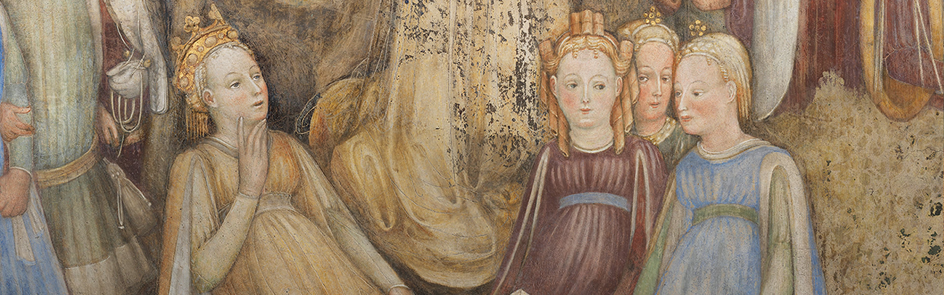 MonzaCappella di Teodolinda
(ciclo pittorico degli Zavattari) -
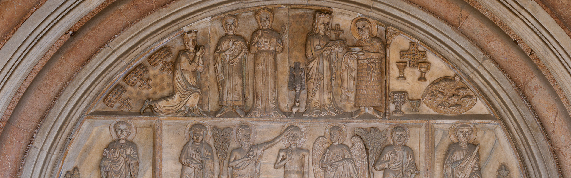 MonzaLunetta del Duomo
 -
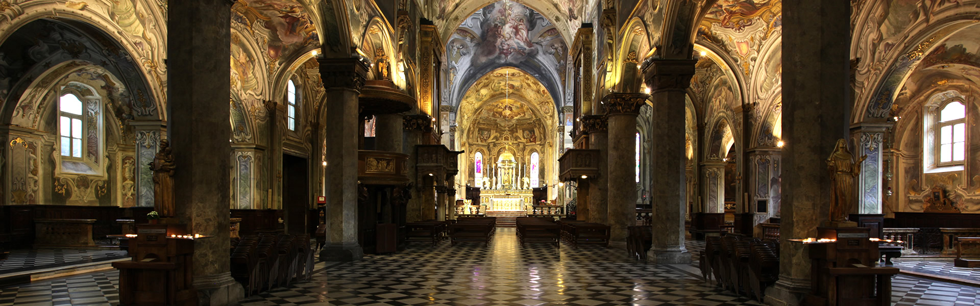 MonzaInterni del Duomo
 -
 MonzaCorona Ferrea
 -
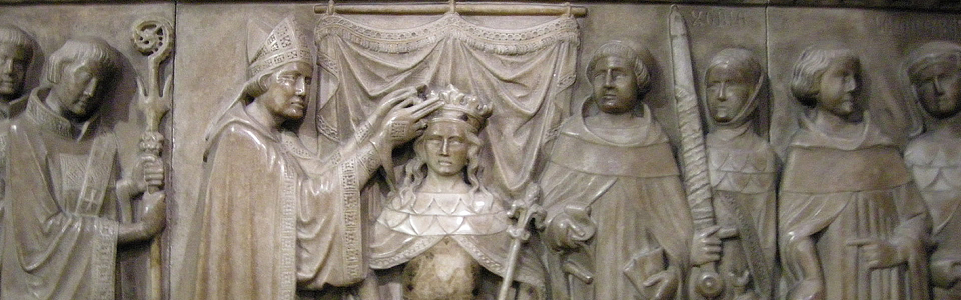 MonzaBassorilievo delle incoronazioni
 -
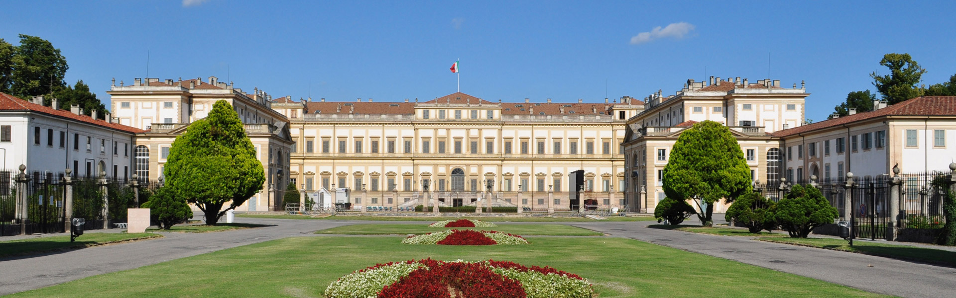 MonzaReggia
tourism cluster Monza Brianza
In the context of the Itinerary “Longobard Ways across Europe”, a leading role - as a destination for cultural tourism - is played by the Cluster of Monza-Brianza, the territorial identification of which is the result of the historic and geographic value of this area in the period of the actual foundation of the Longobard Kingdom of Italy. For simplicity of classification, this period can be indicated as the "Period of the two queens": Theodelinda (589-627) and her daughter Gundeberga (626-652). Their strong influence and the military victories of their husbands - Kings Authari and Agilulf for the former, Kings Arioald and Rothari for the latter - are to be thanked for the territorial enlargements and cultural developments that supported the architecture and the consolidation of the Kingdom.
Borders of the Cluster
The territory of the Cluster of Monza-Brianza fulfilled important military defence functions along strategic axes, which are now of interest for tourism and the environment. Based on strategic historic traces, the borders of the Cluster have been drawn as follows:
- in the North, by the foothills of the Alps and Lake Como (Lario), under threat of invasion from beyond the Alps and where - at the time of the accession of King Authari - the Byzantine fortress of Isola Comacina still resisted, falling into the hands of the Longobards only in 588;
- in the East, by the course of the river Adda that separated Neustria (the Roman IX Regio Transpadana) from Austria (the Roman X Regio Venetia et Histria), marking the division both from the duchy of Bergamo, which rebelled several times against the kings, and from the other Byzantine territories;
- in the West, from the course of the Seveso - as far as Paderno Dugnano - and of the Lambro and, in the South by the line that links Monza to Vimercate and Trezzo sull’Adda: both routes of surveillance and defence of territories subject to Byzantine infiltration.
Road networks
The main road networks of the early Middle Ages and the minor defence works (castra and fortified sites), many of them adapted by the Longobards from previous works by the Romans and the Goths, are also considered from the point of view of history and tourism. The fundamental routes, converging in the direction of the Swiss region beyond the Alps (Raetia Secunda) were: the road to the North, which from Milan - passing through Monza - led to Lake Como, linking up with the consular road to Aquileia; the Roman road that, via the river Adda, led to the imperial metropolis of Aquileia and which - also in the Longobard period - had as strategic junctions and control points along the Como-Bergamo sector the sites of Civate and Garlate, and was overlooked by Monte Barro.